
MONDAY
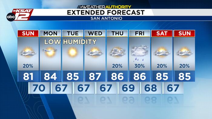
We expect to see more sunshine tomorrow and highs will reach the low 80s. This after morning temps will start in the low 70s and upper 60s in the Hill Country. We’ll also be able to enjoy lower humidity tomorrow, especially in the afternoon and evening.

FINALLY FEELING LIKE FALL
Be prepared for very pleasant weather to start the week! We’ll see more sunshine, lower humidity, and highs in the low-to-mid 80s. An influx of drier air will also help with cooler mornings, with lows in the upper 50s in the Hill Country and low-to-mid 60s elsewhere. Enjoy these refreshing fall-like mornings!

WATCHING THE GULF
The National Hurricane Center is monitoring a 40% chance of development in the Gulf over the next week. While some weather models show tropical development is possible as the system drifts northward, current trends have large discrepancies on how it might evolve later this week. It is too early to focus on specific scenarios or local impacts, so there is no need to panic just yet. However, we will watching the latest developments in the days ahead, so stay tuned for updates!


